Log in
All resources
Create a design
337 Free Artworks of Maps Of Lakes
maps of lake geneva by jacques goulart
science
smithsonian libraries
bibliothèque nationale de france
period
maps by john cary
john cary
wisconsin
smithsonian contributions to knowledge v.7 (1855)
maps from the earth and its inhabitants, vol. vii
maps of the san francisco bay area
1854 maps of california
maps by willem and johannes blaeu
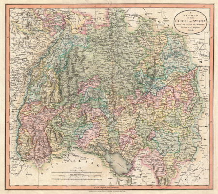
old maps of swabia
old maps of the sea of galilee
french-language maps
catalan atlas
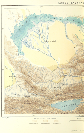
issyk-kul
through the subarctic forest (1896) by pike
1890s maps of alaska
maps by john cary
1799 maps
through the subarctic forest (1896) by pike
1890s maps of alaska
science
maps
science
maps
19th-century maps of south holland
netherlands in the 1860s
science
maps
maps from the earth and its inhabitants, vol. vi
old maps of kyrgyzstan
maps from the earth and its inhabitants, vol. vi
old maps of kyrgyzstan
18th-century double hemisphere world maps
1730s maps of the world
1740s maps of the americas
1747 maps of north america
18th-century double hemisphere world maps
1730s maps of the world
advertising posters for the chemins de fer de paris à lyon et à la méditerranée
hugo d’alesi
science
maps
science
maps
1650s maps of the americas
1658 maps
description de l'universe
1710s maps of ethiopia
maps of lake geneva by jacques goulart
bibliothèque nationale de france
maps of lake geneva by jacques goulart
bibliothèque nationale de france
maps of lake geneva by jacques goulart
bibliothèque nationale de france
richard wane
port erin
atlas minor gerardi mercatoris (1621, maps)
maps of lake geneva by jacques goulart
science
maps
science
maps
old maps of the western hemisphere
jacob van meurs
1821 maps of the united states
maps by john cary
1770s maps of alaska
robert de vaugondy
eran laor cartographic collection
willem albert bachiene
1696 maps of the caribbean
1690s maps of mexico
arnold's geographical handbook (1899)
1899 maps of the united states
drawings by leonardo da vinci in the royal collection of the united kingdom
high renaissance,renaissance
geocentric model
1730 maps
fauna bl - mammalia
moose in art
1876 maps of the united states
old maps of new england
maps by willem and johannes blaeu
1610s maps of the americas
maps in the library of congress
1771 maps of north america
maps from the earth and its inhabitants, vol. iv
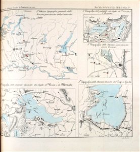
old maps of the lake district
maps from the earth and its inhabitants, vol. iv
old maps of the lake district
science
maps
maps of lake geneva by jacques goulart
eran laor cartographic collection
maps of lake geneva by jacques goulart
eran laor cartographic collection
maps of paris from the david rumsey historical map collection
maps of paris by caspar merian
old maps of swabia
maps by john cary
maps from the earth and its inhabitants, vol. vii
treaty ports
high renaissance,renaissance
codex atlanticus
maps from the earth and its inhabitants, vol. x
maps of lake victoria
1779 maps of the united states
1770s maps of the caribbean
lawrence h. slaughter collection of english maps, charts, globes, books and atlases
covens en mortier
dr. wilh. junker's reisen in afrika 1875-1886
old maps of lake victoria
english-language maps of asia
maps by john cary
french-language maps of north america
1809 maps of north america
maps from the earth and its inhabitants, vol. x
john hanning speke
ismailïa. a narrative of the expedition to central africa for the suppression of the slave trade (1874)
nyanza, rwanda
gemeente atlas van nederland - south holland
maps of alkemade
atlas minor gerardi mercatoris (1614, maps)
maps of lake geneva by jacques goulart
africa in the 18th century
1794 maps of africa
africa in the 18th century
1794 maps of africa
atlas sive cosmographicae (gerardus mercator, 1607)
maps of lake geneva by jacques goulart
atlas sive cosmographicae (gerardus mercator, 1623)
maps of lake geneva by jacques goulart
maps from the earth and its inhabitants, vol. x
maps of lake victoria
les nabis,impressionism,symbolism,post-impressionism,art nouveau
paintings by félix vallotton in the musée de pully
maps by louis brion de la tour
1786 maps of north america
cartography
maps
maps from the earth and its inhabitants, vol. vii
ebi lake
1806 maps of the united states
maps by john cary
maps from the earth and its inhabitants, vol. x
lake tana
maps from the earth and its inhabitants, vol. vii
qinghai lake
maps from the earth and its inhabitants, vol. vii
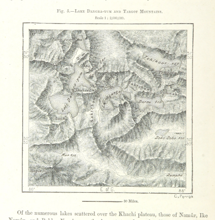
targot mountains
maps from the earth and its inhabitants, vol. xiii
mount kenya
maps of lake geneva by jacques goulart
bibliothèque nationale de france
carte du mexique et de la floride by guillaume delisle (1703)
french-language maps of mexico
maps from the earth and its inhabitants, vol. ix
urmia lake
maps from the earth and its inhabitants, vol. ix
lake hāmūn
maps from the earth and its inhabitants, vol. vii
lake palti
maps from the earth and its inhabitants, vol. ix
egherdir lake
maps from the earth and its inhabitants, vol. vii
lake mansaraur
encyclopédie méthodique - géographie physique
ambroise tardieu
maps from the earth and its inhabitants, vol. xiv
maps of batangas
maps of paris from the david rumsey historical map collection
1778 in paris
nouvelle géographie universelle, vol. xvii
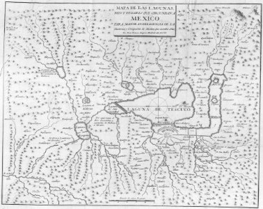
maps of texcoco lake, mexico
maps of the dutch east india company - bengal
maps of the dutch east india company - india
cartography
maps
nouvelle géographie universelle, vol. vi
maps of lakes of russia
maps from the earth and its inhabitants, vol. xvii
lake champlain
charles bentley (painter)
eastern tepuis
maps from the earth and its inhabitants, vol. xvii
lake champlain
maps from the earth and its inhabitants, vol. iv
lake area comparison diagrams
dr. wilh. junker's reisen in afrika 1875-1886
old maps of lake victoria
a class-book of modern geography (1898)
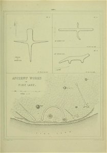
maps of the lake district
a class-book of modern geography (1898)
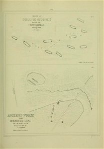
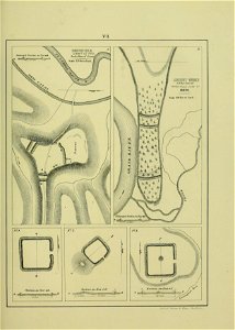
old maps of the great lakes
1807 maps of south america
maps by john cary
narrative of an expedition to the zambesi and its tributaries
david livingstone's travels in maps
atlas sive cosmographicae (gerardus mercator, 1630)
maps of lake geneva by jacques goulart
lawrence h. slaughter collection of english maps, charts, globes, books and atlases
covens en mortier
westmorland, cumberland, durham, and northumberland (1858)
old maps of westmorland
maps in the library of congress
1777 maps of north america
201 - 300 of 337
Next page
/ 4